Categories
Sites

Emhjellevatnet

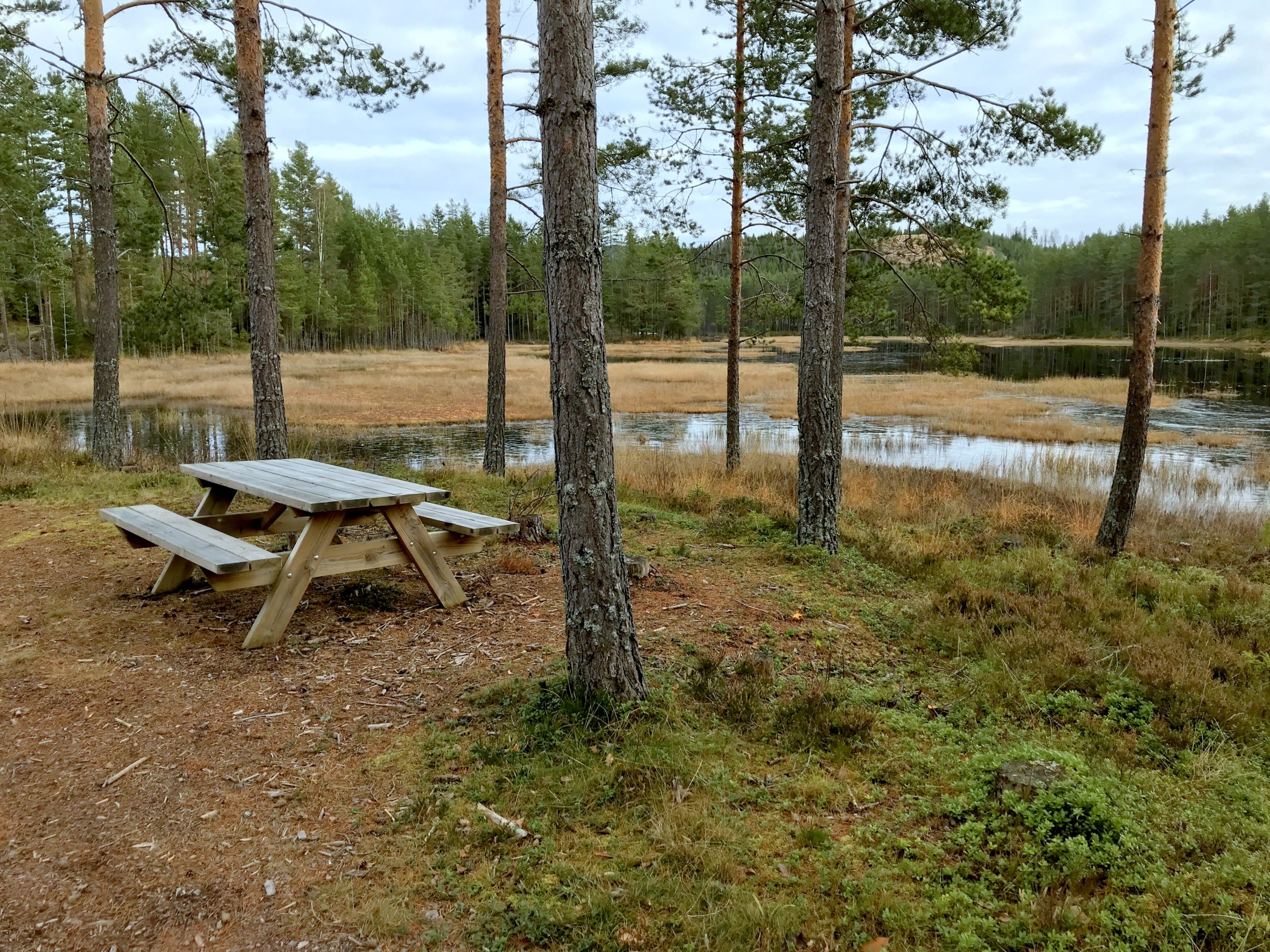
A large gravel space often used as a freecamp, well retracted from the road.

Located in Gloppen municipality in Nordfjord in Sogn og Fjordane.

Gloppen is the site of Karnils burial mound (Karnilshaugen). Karnilshaugen or Tinghaugen på Hauge is located on the Hauge farm west of Sandane. Karnilshaugen is probably one of the ten largest mounds in Nordfjord. The burial mound was built on top of Tinghaug, the site of a Thing (assembly). Tinghaug was a place of public gathering, for cultural events and religious actions.

61.6168, 5.6860

View_200_Trans

Beatiful scenery

Caravan_200_Trans

Caravans OK

Tent_200_Trans

Tents OK

Bathing

Possibilities for bathing

FishFreshWater

Freshwater fishing

ForestArea_200_Trans

Forest area

Footpaths_200_Trans

Footpaths

Categories
Sites

Skarsvåg

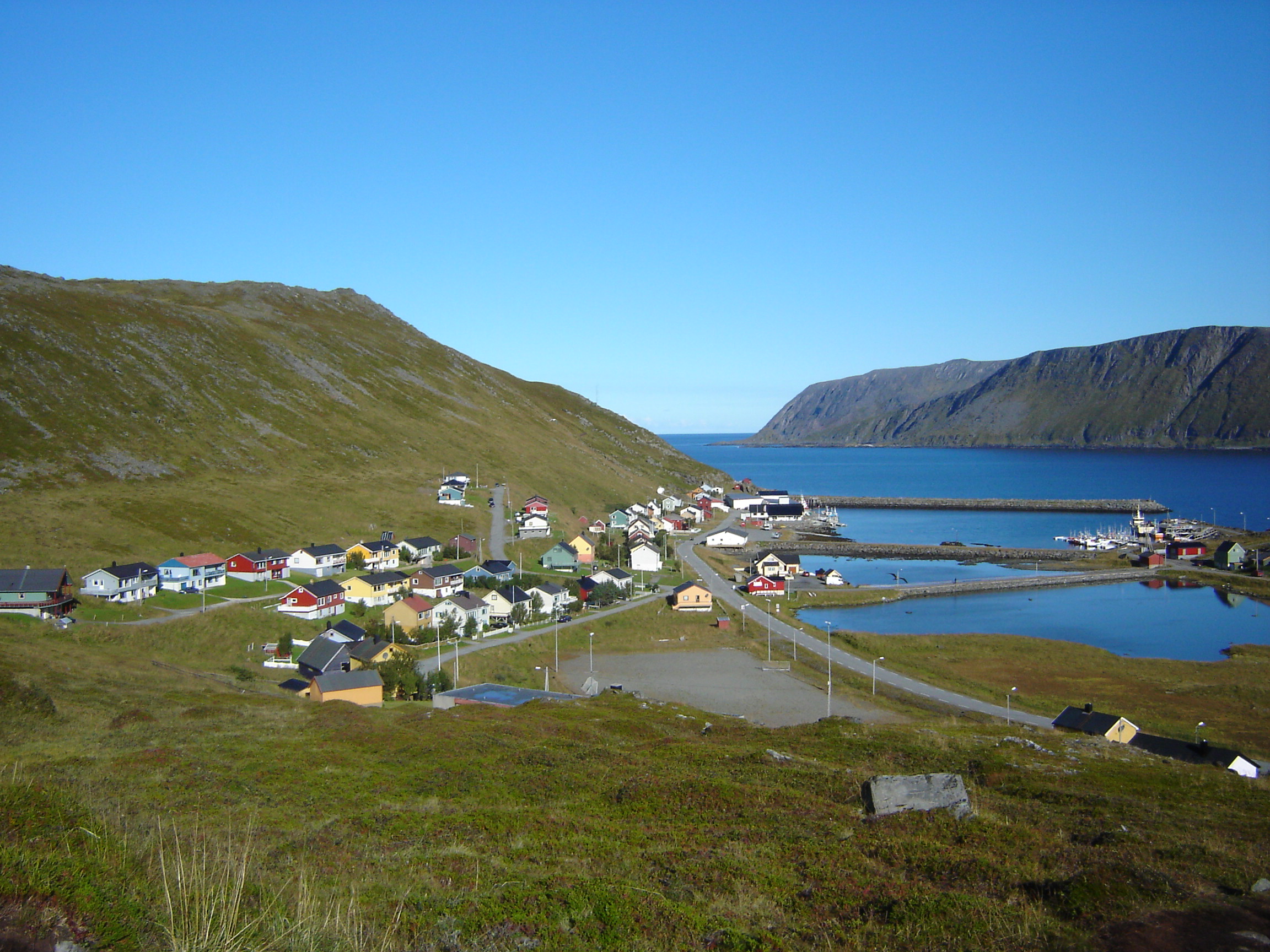
Skarsvåg is the world's northernmost fishing village, with approx. 90 inhabitants. The place is located at the Risfjorden on the northeast side of Magerøya in Nordkapp municipality in Finnmark.

From Skarsvåg, it is 14 km to the North Cape Plateau and this is a great free site to stay overnight in connection with a visit to the northernmost point of the continental Europe.

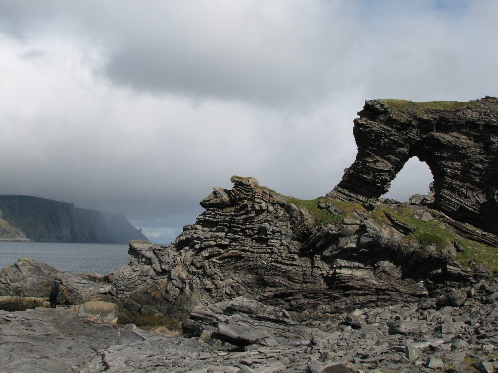
There are no facilities for motorhomes or campers, but there is a shop and cafe in the harbor. The area is well suited for hiking. “Kirkeporten” or The Church Gate is a 45 minutes hike northwards or it is nice to walk around in the harbor. “Kirkeporten” is a geological treat; a several meters wide break through a rocky ramp formed as a large gate. Through this gate the midnight sun shines between 2400 and 0200.

71.1132, 25.8285

View_200_Trans

Beatiful scenery

Caravan_200_Trans

Caravans OK

Bathing

Possibilities for bathing

FishSaltWater

Saltwater fishing

AllYear_200_Trans

Open/accessible all year

POI_200_Trans

Near point of interest

SeaArea_200_Trans

Sea area

NearTown_200_Trans

Near town

Footpaths_200_Trans

Footpaths

Categories
Sites

Smines

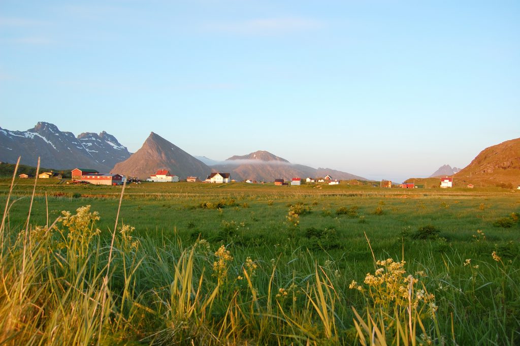
Incredibly nice and quiet freecamp space. Beautiful views and fishing opportunities in the sea. Extremely low traffic as this is near the end of the road.

There are several other opportunities for freecamping along the road towards Smines. Smines is located at Sortland in Vesterålen to the north of Lofoten. The area is rich in archaeological finds, and findings show that it has been settlement here from the younger stone age.

68.8552, 14.9892

View_200_Trans

Beatiful scenery

Caravan_200_Trans

Caravans OK

Bathing

Possibilities for bathing

FishSaltWater

Saltwater fishing

SeaArea_200_Trans

Sea area

Categories
Sites

Ståvassdammen

This freecamp-site are located aproximately 1000m over sea level. A fantastic starting point for hikes by foot or skiing.

The area are located well above the tree line and there are a lot of opportunities to park Your motorhome, camper or even to stay for some time in a tent. Haukeliseter is a very popular start and end point for people who are trekking between the mountain cabins following the Norwegian Trekking Association’s (DNT:s) marked routes. There are very good trails and cabins both south and north of Haukeliseter in Hardangervidda national park and Setesdalsheiene. At Haukeliseter fjellstue You will be able to endulge in a relaxing wilderness spa in the afternoon and enjoy delicious food in the company of others during the evening.

At Haukeliseter you can also attend many different tours and events throughout the year, ranging from kite courses, dog sledding and children’s activities to music festivals.

59.8138, 7.2053

View_200_Trans

Beatiful scenery

Caravan_200_Trans

Caravans OK

Tent_200_Trans

Tents OK

Bathing

Possibilities for bathing

FishFreshWater

Freshwater fishing

FirePit

Firepit or grill

MountainArea_200_Trans

Mountain area

Footpaths_200_Trans

Footpaths

SkiTrails_200_Trans

Ski trails

Categories
Sites

Kråkholmen

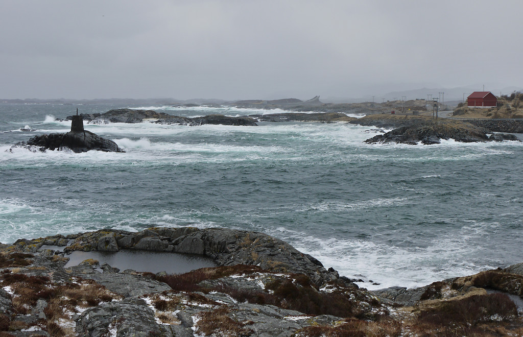
One of the better freecamping spots to rest before or after travelling over the atlantic road.

There are sculpture art placed along a short walking path and a fantastic view over to the old tradingpost “Teistklubben”. Gravel freecamp at 63.001, 7.2177 and a grassy area for camping at 63.0013, 7.2192.

The Atlantic road or “Atlanterhavsvegen” is a unique stretch of road which takes you right out to the ocean’s edge. In 2005, the road was voted Norway’s «Engineering Feat of the Century», and is also known to be the world’s most beautiful drive. The Atlantic Road has National Tourist Route status and the entire stretch between Bud and Kristiansund is one continuous experience packed with coastal scenery, culture and history. 

63.0019, 7.2177

View_200_Trans

Beatiful scenery

Caravan_200_Trans

Caravans OK

Tent_200_Trans

Tents OK

Bathing

Possibilities for bathing

FishSaltWater

Saltwater fishing

FirePit

Firepit or grill

PicnicTable_200_Trans

Picnic table

Trash_200_Trans

Trash disposal

AllYear_200_Trans

Open/accessible all year

POI_200_Trans

Near point of interest

SeaArea_200_Trans

Sea area

Categories
Sites

Fosnavåg

Free site with free services!

Free electricity, waste disposal and freshwater at the site. Situated behind at a parking lot, but camping behavior is allowed.

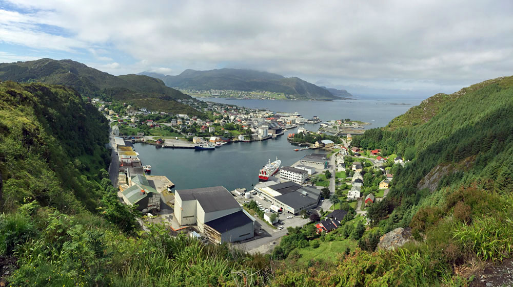
Fosnavåg are a small community with about 4000 inhabitants.Fosnavåg has its own coastal charm with exiting shops, nice cafés, fishing boats and a special atmosphere. The main road can not be driven by car. It goes from the inner harbor to the sea.

Other services as toilet and greywater disposal at Lanternen Marina (62.3137, 5.7082) See picture below.

62.3404, 5.6339

Bathing

Possibilities for bathing

FishSaltWater

Saltwater fishing

Trash_200_Trans

Trash disposal

AllYear_200_Trans

Open/accessible all year

POI_200_Trans

Near point of interest

SeaArea_200_Trans

Sea area

NearTown_200_Trans

Near town

Electric_200_Trans

Electricity

FreshWater_200_Trans

Freshwater available

Categories
Sites

Bakkefløyta

Freecamping in the eastern wilderness

A fine spot near dam system. Shelter, picknictable and firepit. Good startingpoint for walking or skiing. Use GPS-viapoint at 60.3807, 11.6886 to find the correct gravel road leading up to the site.

The site are located in the “Austvatn” area east of Storsjøen in Nord-Odal mucipality.

60.3902, 11.7085

View_200_Trans

Beatiful scenery

Caravan_200_Trans

Caravans OK

Tent_200_Trans

Tents OK

Bathing

Possibilities for bathing

FishFreshWater

Freshwater fishing

FirePit

Firepit or grill

Shelter_200_Trans

Shelter

PicnicTable_200_Trans

Picnic table

ForestArea_200_Trans

Forest area

Footpaths_200_Trans

Footpaths

SkiTrails_200_Trans

Ski trails

Categories
Sites

Sømnesvika

Gravel freecamp near marina for small boats. Very little traffic.

Several opportunities for freecamping in the area. 

Archaeological excavations show that Sømna has been inhabited from the ancient Iron Age to the present day. At the end of the Middle Ages, Sømna (Sør-Sømn) was separated as a separate muncipality under Alstahaugsysla.

This free campsite are located near “Kystriksveien” (The costal road – FV17) and we will later post a trip idea for travelling along this road.

65.3650, 12.1707

View_200_Trans

Beatiful scenery

Caravan_200_Trans

Caravans OK

Tent_200_Trans

Tents OK

Bathing

Possibilities for bathing

FishSaltWater

Saltwater fishing

SeaArea_200_Trans

Sea area

Categories
Sites

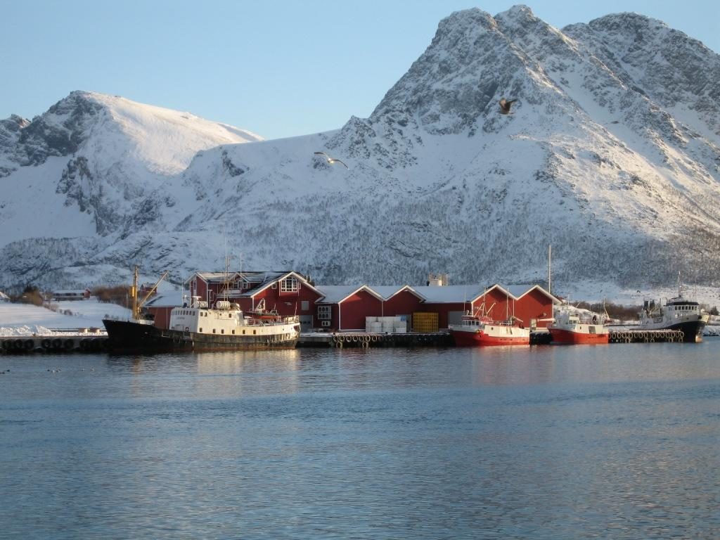
Abelvær

Beautiful scenery at several opportunities for freecamping in this area.

You can also try the freecamp sites at (64.7392, 11.1985) or (64.7377, 11.2067).

The old trading post Abelvær is known from written sources in the early 17th century, but the farm can be traced even further back in history. Abelvær was part of the property “Ramstad”, known as “Rafnista” in Egils saga. One of the earliest landmembers in Iceland, Kjetil Høngur, came from Rafnista, according to the  saga.

Abelvær is a fishing village and trading center, furthest south in Nærøy municipality in Trøndelag, at the end of the peninsula which extends southwest from the mainland and out into Folda. Starting  in 1802 Abelvær was built around the Brandtzæg family businesses with canning factory, trade, dairy, bakery and more.  Abelvær farm is now operated as a lodging and accommodation establishment.

The “Styrmanden” cafeteria offers coffee, cakes and “snacks”, but can serve up to full lunch or dinner for up to 20 people on order.

64.7382, 11.2061

View_200_Trans

Beatiful scenery

Caravan_200_Trans

Caravans OK

Tent_200_Trans

Tents OK

Bathing

Possibilities for bathing

FishSaltWater

Saltwater fishing

SeaArea_200_Trans

Sea area

Footpaths_200_Trans

Footpaths

Categories
Sites

Avløysinga – Lofoten

Great freecamp at Røssøystraumen bridge. Opportunities for great fishing in the tidal currents.

Røssøystraumen is a narrow sound or channel in Flakstad municipality in Nordland that runs between Moskenesøya on the west side and Torvøya on the east side. The sound is about 850 meters long and runs from Rambergvika on the north side to Hovdanvika on the south side. Together with Sundstraumen further south, it is part of a passage between the Norwegian Sea and the Vestfjord. Maximum depth is 9 meters.

The nearest village is Fredvang. The village is located on the island of Moskenesøya and is fairly isolated with the Fredvang Bridges being the only road connection to the rest of Norway.

68.0841, 13.1881

View_200_Trans

Beatiful scenery

Caravan_200_Trans

Caravans OK

Tent_200_Trans

Tents OK

Bathing

Possibilities for bathing

FishSaltWater

Saltwater fishing

AllYear_200_Trans

Open/accessible all year

SeaArea_200_Trans

Sea area