Categories
Featured

Hestsundet (Tjøtta)

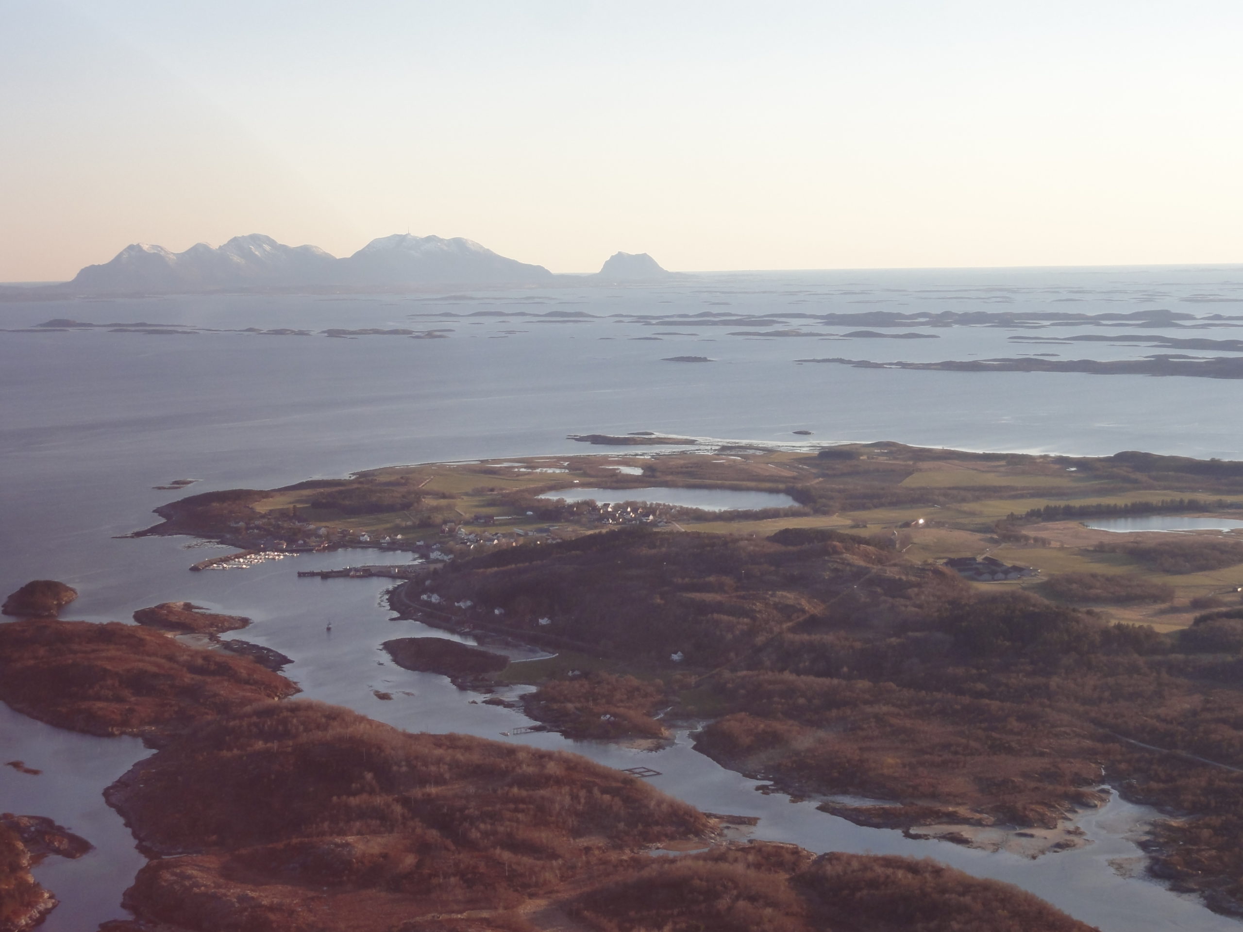
Freecamp at a large recreational area next to the road. Amazing view. Several other freecamp sites in the area.

Tjøtta is mentioned in the Heimskringla many times; this was the home of Hárek of Tjøtta, one of the leaders of the peasant army which killed Olav Haraldsson at the Battle of Stiklestad. There is archeological evidence of Iron Age agriculture in the area- Tjøtta gard, the largest medieval farm in Northern Norway, is also located in Tjøtta.

From 1862 until 1965, the village of Tjøtta was the administrative centre of the old municipality of Tjøtta.

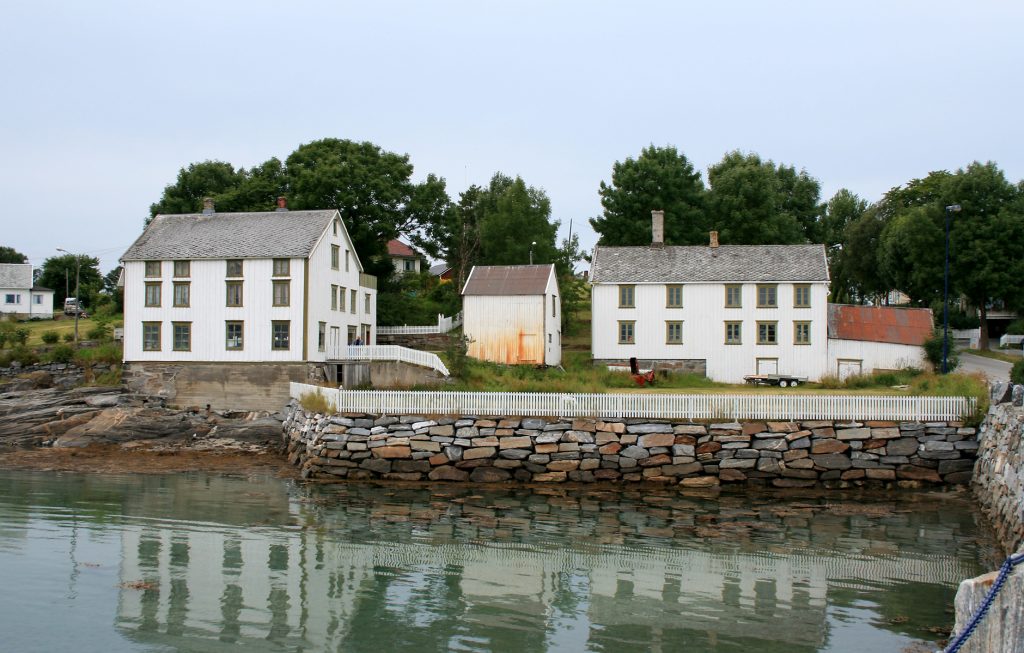
Photo below : Tjøtta Handel – 28.07.2007 – Mahlum
65.8556, 12.4235

View_200_Trans

Beatiful scenery

Caravan_200_Trans

Caravans OK

Tent_200_Trans

Tents OK

Bathing

Possibilities for bathing

FishSaltWater

Saltwater fishing

FirePit

Firepit or grill

SeaArea_200_Trans

Sea area

Footpaths_200_Trans

Footpaths

Categories
Featured

Røssjørompa

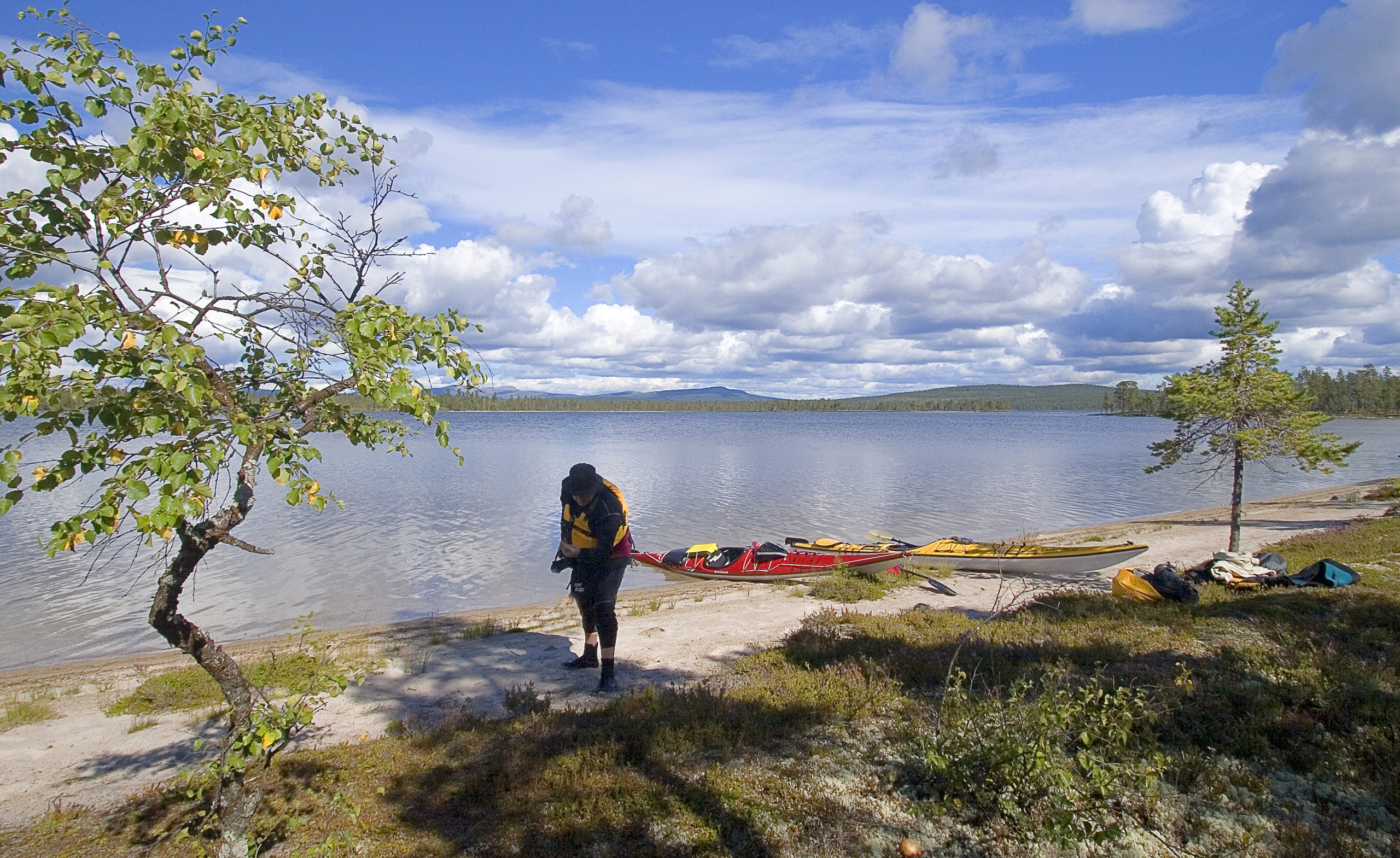
Peaceful grassy area in Røssjøen Nature Reserve

This site are located on a grassy area well suited for freecamping. There are a picnic table and firepit on the spot. A path down to the water makes an easy access for fishing or bathing in the lake.

Røssjøen Nature Reserve is located next to Langsua National Park in the municipalities of Etnedal, Nord-Aurdal and Nordre Land. The area was protected 11.3.2011. The nature reserve has larger and smaller lakes, large marshes and dry ridges with old pine forest. The area is grazed, and is important for rare birds and plant species.

Røssjøen Nature Reserve is part of the conservation plan for Langsua National Park.

More possibilities for freecamping at the rest area located at 61.1242, 9.7204 where there are room for many campers over a larger area. See below :

61.1242, 9.7131

View_200_Trans

Beatiful scenery

Caravan_200_Trans

Caravans OK

Tent_200_Trans

Tents OK

FishFreshWater

Freshwater fishing

FirePit

Firepit or grill

PicnicTable_200_Trans

Picnic table

ForestArea_200_Trans

Forest area

Footpaths_200_Trans

Footpaths

Bathing

Bathing

Categories
Sites

Klappedikfossen

Freecamping at recreational area down towards the river Austbygdåe.

Situated in the beautiful nature in Telemark and Sandsetdalen. A popular area for fishing and hiking.

60.0865, 8.7640

View_200_Trans

Beatiful scenery

Caravan_200_Trans

Caravans OK

Tent_200_Trans

Tents OK

Bathing

Possibilities for bathing

FishFreshWater

Freshwater fishing

FirePit

Firepit or grill

PicnicTable_200_Trans

Picnic table

AllYear_200_Trans

Open/accessible all year

ForestArea_200_Trans

Forest area

Footpaths_200_Trans

Footpaths

Categories
Sites

Hjerkinnsdammen

A small freecamp with a view over Hjerkinnsdammen.

The dam was made by Folldal mining in connection with mining in the Tverrfjellet mine at Hjerkinn. The vaste from the mine was deposited in the Hjerkinn Dam, an artificial lake and sludge pond. Mining started in 1964 and ceased in March 1993.

Hjerkinn is located at the highest point at the kings road to Trondheim.

62.2111, 9.5998

View_200_Trans

Beatiful scenery

Caravan_200_Trans

Caravans OK

Tent_200_Trans

Tents OK

FishFreshWater

Freshwater fishing

MountainArea_200_Trans

Mountain area

Footpaths_200_Trans

Footpaths

SkiTrails_200_Trans

Ski trails

Categories
Sites

Haldammen

Old damsystem buildt for floating of timber.

Haldammen is an old listed damsystem for timber floating. There has been activity here since the first water wheel and a mill was built in the 1600s. In 1804 the first dam was completed and the floating was continued until 1981.

Today you can see some old huts and the dam itself. Some of the huts is open to the public to use for accommodation and bonfires. Space for 2 campers for overnight stay in the free parking lot. You have to pay a small access-fee to use the gravel roads for access into this site.

Every year, in early June, “Haldamsdagene” is arranged. While these are going on, old traditions of craftsmanship is shown and visitors can try out different old craftmanships. During these days timber floating is also demonstrated, and the timberslip over the Haldamstupet takes place when the water in the dam is released.

60.8543 – 12.3055

View_200_Trans

Beatiful scenery

Caravan_200_Trans

Caravans OK

Bathing

Possibilities for bathing

FishFreshWater

Freshwater fishing

FirePit

Firepit or grill

Shelter_200_Trans

Shelter

PicnicTable_200_Trans

Picnic table

Trash_200_Trans

Trash disposal

POI_200_Trans

Near point of interest

ForestArea_200_Trans

Forest area

Footpaths_200_Trans

Footpaths

Categories
Sites

Bøsanden

Freecamping at the parking area for the recreational area of Bøsanden - One of the natural wonders of northern Norway.

The road down to this freecamp is narrow and with relatively deep wheel tracks. Not suitable for the largest motorhomes. It is not allowed with camping at the parking, but there are a lot of opportunities in the grassy area around the parking itself.  On days of warm and sunny weather, this is a popular spot for bathing and hiking. This is also a perfect place to enjoy the sunset and possibly the midnight sun.

Located at the western side of Engeløya (translates to: Angel island). See also the sidebar under “More Info” for link to other spetacular places in this part of Norway.

67.9662, 15.0527

View_200_Trans

Beatiful scenery

Caravan_200_Trans

Caravans OK

Tent_200_Trans

Tents OK

Bathing

Possibilities for bathing

FishSaltWater

Saltwater fishing

FirePit

Firepit or grill

SeaArea_200_Trans

Sea area

Footpaths_200_Trans

Footpaths

Categories
Sites

Kongsodden

Large area for freecamping at the shores of "Femunden".

This is a popular spot for starting a canoeing or fishing expedition into the wilderness at “Femundsmarka National Park”.

Formed in 1971 to protect the lake, forests, marshes and mountain peaks of the area around Femunden. This 573-sq-km park is often overlooked by foreign tourists – despite the fact that it’s been named one of the three best hiking areas in Norway.

The area, situated between the border with Sweeden and the cities of Trysil and Røros, has 67 mountain peaks and two national parks, Femundsmarka and Gutulia. Hiking, canoeing and cycling hardly become more family-friendly than here.

Flyfishing in the rivers is popular. In addition, there are more than 900 beatiful waters and Norway’s third biggest lake “Femunden”, trafficked by the ferry M/S Fæmund II built as early as 1904. Here ant in other waters you can expect fish species like trout, char, grayling, whitefish, perch and pike.

61.9425, 11.9364

View_200_Trans

Beatiful scenery

Caravan_200_Trans

Caravans OK

Tent_200_Trans

Tents OK

Bathing

Possibilities for bathing

FishFreshWater

Freshwater fishing

ForestArea_200_Trans

Forest area

Toilets

Toilets

Footpaths_200_Trans

Footpaths

Categories
Sites

Geitvika

Freecamp with a fantastic view over the fjord towards Skjervøya and Laukøya.

Geitvika freecamp are located in Skjervøy municipality in Troms county. This area of Norway is a natural gem with great opportunities for recreation with fishing and hiking. See sidebar under More Info for more information.

There are other opportunities for freecamping in this area. Check out Gammelflåten at (69.9401, 20.9262) and Sandbukta at (69.9515, 20.9536)

70.0060, 20.8980

View_200_Trans

Beatiful scenery

Caravan_200_Trans

Caravans OK

Tent_200_Trans

Tents OK

Bathing

Possibilities for bathing

FishSaltWater

Saltwater fishing

PicnicTable_200_Trans

Picnic table

AllYear_200_Trans

Open/accessible all year

SeaArea_200_Trans

Sea area

Categories
Sites

Vågedalsveien

Undisturbed freecamp site with beautiful view over Brimsefjorden. Gravel space near marina.

Several other options for staying overnight in the area. Check out marina at 59.0818, 5.7805

Rennesøy is an island muncipality in Rogaland county located near the city Stavanger. Since 1992, Rennesøy municipality has been connected to the mainland by a series of bridges and undersea tunnels. The European higway E39 connects to the island of Vestre Bokn via a ferry connection.

59.0895, 5.7808

View_200_Trans

Beatiful scenery

Caravan_200_Trans

Caravans OK

Tent_200_Trans

Tents OK

Bathing

Possibilities for bathing

FishSaltWater

Saltwater fishing

PicnicTable_200_Trans

Picnic table

Trash_200_Trans

Trash disposal

SeaArea_200_Trans

Sea area

Categories
Sites

Aunvatnet

Gravel freecamp site, withdrawn from the road at Aunvatnet. Picnic tables and garbage disposal.

The site are located at the island of Føya, which lies north of the island of Hitra, as well several thousand other small islands surrounding the island of Frøya. The main island of Frøya is connected to the neighboring island of Hitra (and ultimately the mainland of Norway) by the Frøya Tunnel.

In Norse mythology, Freyja (Frøya) is a goddess associated with war, death, love, sex, beauty, fertility, gold, and sorcery. Freyja is the owner of the necklace Brislingamen, rides a chariot pulled by two cats, is accompanied by the boar Hildisvini, and possesses a cloak of falcon feathers.

The island of Frøya offers great fishing opportunities – whether you like deep sea fishing or inland fishing. Rent a boat and fishing gear and join local fishing guides out on the open sea who know where the big fish bite.

With its wide range of local food manufacturers and high-quality restaurants, Trøndelag can rightfully be called a culinary region. If you want to please your tastebuds, we suggest you visit some of the various shops selling local produce from farmers and small-scale producers.

There are several other opportunities to stay overnight in the area, check out freecamp at 63.6938, 8.5885 and also the gravel site at a small harbor at 63.7246, 8.6182

63.7170, 8.6172

View_200_Trans

Beatiful scenery

Caravan_200_Trans

Caravans OK

Tent_200_Trans

Tents OK

Bathing

Possibilities for bathing

FishFreshWater

Freshwater fishing

PicnicTable_200_Trans

Picnic table

Trash_200_Trans

Trash disposal

SeaArea_200_Trans

Sea area